CAMEL (2012-2013)
Characterization and classification of dune fields on Mars based on Earth analogues
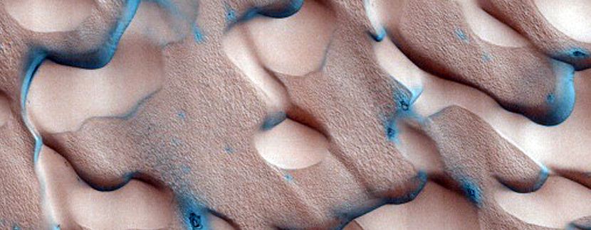
Martian dune field observed in HiRISE image [NASA/JPL/University of Arizona].
Project details
Funding organization
Fundação para a Ciência e a Tecnologia (FCT), contract PTDC/CTE-SPA/117786/2010
Period
January 2012 - December 2014
Principal Contractor
Centro de Geofísica, Universidade de Coimbra (CG/UC)
Principal Investigator
Teresa Barata (CG/UC)
Participating Institutions
Centro de Recursos Naturais e Ambiente, Instituto Superior Técnico (CERENA/IST)
International Research School of Planetary Sciences, Universitá d'Annunzo (IRSPS)
Team members
CG/UC - Adriane Machado, David Vaz, Ivo Alves and Teresa Barata
CERENA/IST - José Saraiva, Lourenço Bandeira and Pedro Pina
IRSPS – Gian Gabriele Ori
Summary
Objectives
Dunes are common features on planetary surfaces where unconsolidated material is present in abundance and responds to an atmosphere capable of producing significant winds. Wind is the most important erosive agent on present-day Mars, and the availability of large amounts of loose sand and dust provides conditions for the existence of dune fields all over the planet. They are the most frequent aeolian features on the Martian surface; their study contributes to the understanding of interactions between the atmosphere and the surface of the planet, thus allowing the development of both atmosphere and sedimentology studies. The role played by wind regimes in the formation and evolution of dune fields on Mars can provide clues to the history of the climate of the planet.
Identification and characterization of dune fields on Mars started in the 1970s, on a global scale. Visual data from the Viking mission orbiters consisted mostly of images whose spatial resolution did not allow for detailed studies of the fields identified, which were seen to cover large (kilometric) areas of the surface. The instruments currently orbiting Mars, however, acquire digital images with much better spatial resolution, allowing for discovery and analysis of dunes of smaller dimensions occurring in sets or isolated, in every type of terrain.
The Mars Dune Consortium is a group of planetary scientists whose stated intention is to create a catalogue containing all dune fields identifiable on the surface of Mars. According to them, a huge effort and cooperation among planetary scientists is necessary to enlarge the database, deepen the knowledge on these features and improve our understanding of the fundamental processes underlying their formation. Their work is available online in a geographical database (the Mars Digital Dune Database, MDDD); the searching and delineation of dune fields is performed manually, and by their own calculations there are still many Martian dune fields to be identified and characterized.
Manual identification and analysis of geomorphological features on images are hard, time-consuming and subjective tasks, drawbacks that can be surpassed with our current knowledge and experience on the use of automated procedures for the analysis of images of planetary surfaces; these can play an important role in this type of research, by mapping the dune fields present on the images and then making a number of measurements on them, all without human intervention. The team involved in this project intends to develop a methodology to automatically delineate dune fields in remotely sensed images of the Martian surface, extract their characteristics and perform their classification (based on the types of dunes commonly recognized on the Earth). The method will be able to detect dunes of all sizes and shapes in all types of terrains, whenever the spatial resolution of the images employed allows for their identification. For the development of this methodology we will use optical images acquired by the most recent NASA and ESA probes (MRO, Mars Express, Odyssey and MGS).
The development and testing of our automated approach will be based on a selection of images, containing representative samples of the visually diverse Martian dune field types; these will be first analysed by human experts, to obtain the ground-truth sets that will be compared with the automated outputs, in order to validate the procedure. Next, dimensional and morphologic parameters will be used to characterize the different dune patterns, and correlated with other information such as latitude, altitude and aeolian regime; this may provide clues into the relations between the morphology of dunes and their formation processes. The study of planetary surface features and the processes involved in their genesis is often based on Earth analogues (assuming that similar structures and landscapes will likely have the same origin); given the impossibility of using direct in-situ information on Martian landforms, we will compare the Martian dune field quantitative characteristics with those from terrestrial analogues, in order to obtain clues about the transportation and deposition processes that created them.
The fully validated methodology will then be employed in a systematic effort to map dunes on the surface of Mars, using the extensive archive of images currently available. This will allow for significant contributions into the existing catalogue, and to probe issues such as rate and importance of changes that may have occurred in particular dune fields, as well as the reasons for the absence of changes in others.
In summary, the main objectives of the project are:
- The development of an automated methodology to delineate, characterize and classify dune fields on Mars using optical images
- The establishment of analogies, in an objective and quantitative manner, between the dune fields of Mars and Earth
Activities
The project is organized into 4 main tasks:
- Image selection and preliminary analysis – The objective of this task expand the existing database of Martian dune field images which has been established in the framework of previous studies into this subject.
- Methodology development and validation - This task comprises the development of a methodology for the identification and characterization of dune fields on images of the surface of Mars, based on an approach employed in preliminary attempts.
- Application to terrestrial analogues - In this task we will endeavour to widen the capacities of the methodology and prepare the next phase of the project, taking into account the major goal of significantly contribute to the knowledge about dunes and dune fields on Mars. For that purpose, we will collect data on terrestrial dune fields, which are viewed as analogues for the Martian features under study.
- Mapping of Martian dune fields - After the methodology is fully developed and validated, we will conduct a widespread campaign of dune field mapping on Mars, applying our methodology to the images available from diverse sensors.
