HISURF (2012-2013)
Very high resolution imaging for detailed surface mapping in ice-free areas of Maritime Antarctica
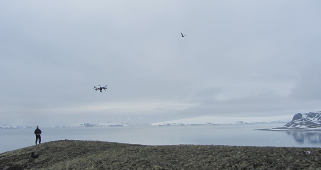
Operating an UAV for image acquisition in Barton Peninsula, King George Island, Antarctica (January 2013).
Project details
Financial and logistics support
Portuguese Polar Program (PROPOLAR), Instituto de Geografia e Ordenamento do Território (IGOT), Centro de Recursos Naturais e Ambiente (CERENA), Instituto Antártico Chileno (INACH), Korean Polar Reserach Institute (KOPRI)
Campaign Period
January 2013 – February 2013
Participating Institutions
Centro de Recursos Naturais e Ambiente, Instituto Superior Técnico (CERENA/IST)
Instituto de Geografia e Ordenamento do Território, Universidade de Lisboa (IGOT/UL)
KOPRI - Korean Polar Research Institute (KOPRI)
Principal Investigator
Pedro Pina (CERENA/IST)
Team members
CERENA/IST – Lourenço Bandeira and Pedro Pina
IGOT/UL – Carla Mora and Gonçalo Vieira
KOPRI - Hyun-cheol Kim and Soon-gyu Hong
Summary
Objectives
The main objective of this project is to make the mapping with unprecedented detail of ice-free areas in Maritime Antarctica using very high resolution remotely sensed images. The level of detail of this cartography is fundamental to better evaluate the evolution of the landscape in one of the regions of the Earth where the climate changes are evolving faster. The acquisition of remotely sensed images of very high spatial resolution will be performed by a camera on an Unmanned Aerial Vehicle (UAV). Extensive ground-truth datasets will be also built using a a D-GPS for precise location of the sampled points. The field campaign will be developed in Barton Peninsula of King George Island (62ºS). The detailed maps that are expected to be obtained from the remote sensing images and field data will be based on image analysis and pattern recognition methods.
Activities
The project is organized around two main tasks:
- first, to make the aerial flights for the acquisition of the imagery in Barton Peninsula and collect all necessary ground data;
- second, to integrate, process and analyze the whole amount of data captured during the field campaign (aerial and ground), using the algorithms developed by the team, to produce surface cover maps.
The first task will be performed during the field campaign and the second task will be mainly developed after the conclusion of the field campaign.
